


Cabot Trail
4.71.9K
#7Hiking in CanadaTravelers' Choice 2025
Sign up free — See who's going and message them.
About
The Cabot Trail is a scenic highway looping around Cape Breton Island’s northern tip in Nova Scotia’s Victoria and Inverness counties.
More photos 11
1 / 11
 Andrea Schaffer · CC BY 2.0 · edited


Why go
- The Skyline Trail, reached from a roadside parking lot in Cape Breton Highlands National Park.
- Whale-watching possibilities at Pleasant Bay.
- Chéticamp, an Acadian fishing village known for hooked rugs.
- Keltic Lodge resort and Cape Smokey Provincial Park at Ingonish.
The trail
- Route type
- Driving route
- Length
- About 300 km
- Course
- Up the west coast, across the northern highlands and south along the east coast.
- Hiking stop
- Near French Mountain, the road passes the Benjie’s Lake hiking trail.
Season and conditions
- The route is open year-round.
What you see
- The northern stretch passes through Cape Breton Highlands and Cape Breton Highlands National Park.
- The southwestern section passes through the Margaree River valley and along Bras d’Or Lake.
Photo spots
- Rugged Atlantic coastOcean views along the route’s western and eastern stretches
History
The highway has been expanded several times since its initial construction.
- 1497The route was named for explorer John Cabot, who reached Atlantic Canada.
- 1932Construction of the initial route was completed.
How to get there
- CarJoin the route west of Baddeck on Route 105. The circuit comprises all of Trunk 30 and Highway 105 between exits 7 and 11.
Shorts
-
 Cabot Trail Fall Foliage: A Scenic Nova Scotia AdventureSmall World Travels
-
 The most view on the Cabot Trail 🤩📍The Skyline Trail, Cape Breton Isl…Fuel For The Sole
-
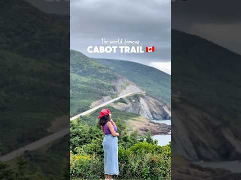 Cabot Trail | Cape Breton Island | Nova Scotia | Canada East Coast | …ExplorewithReshma
-
 5 EPIC CABOT TRAIL STOPS FOR YOUR CAPE BRETON ROAD TRIPYana's Wanderlust
-
 📍Cabot Trail, Cape Breton, Nova ScotiaAdventureNancy
-
 Canada's Cabot Trail, Nova ScotiaKfrance Travels
-
 5 Things to Do on the Cabot Trail, Cape Breton, Nova ScotiaJustin Plus Lauren
-
 Nova Scotia's Scenic Cabot TrailPredator Klash
Sources: Cabot Trail - Wikipedia · Cabot Trail - Wikipedia · Piste Cabot - Wikipedia · checked 1 Oct 2026
Where
Cape Breton Highlands, Cape Breton Island
Plan from here: Evening walk →
Questions and answers
Does the Cabot Trail stay inside Cape Breton Highlands National Park?
No. A short stretch at Pleasant Bay lies outside the park.
Where does Route 19 branch toward Inverness from the Cabot Trail?
At Margaree Forks.
What lies between Cape North and Neils Harbour on the Cabot Trail?
The route passes Cape North near Dingwall, then continues through South Harbour to Neils Harbour.
How invme works
- See who's going — faces, not ticket counts.
- Write to someone who shares your interests — no swipes, no matches, no paywall.
- Pick the event or the place to meet at — and go together.
Reviews on invme
Sign in to reviewLoading comments…