


Geyser del Tatio
Sign up free — See who's going and message them.
Is this your place? Get the badge for your websiteAbout
More photos 5
1 / 5


Why go
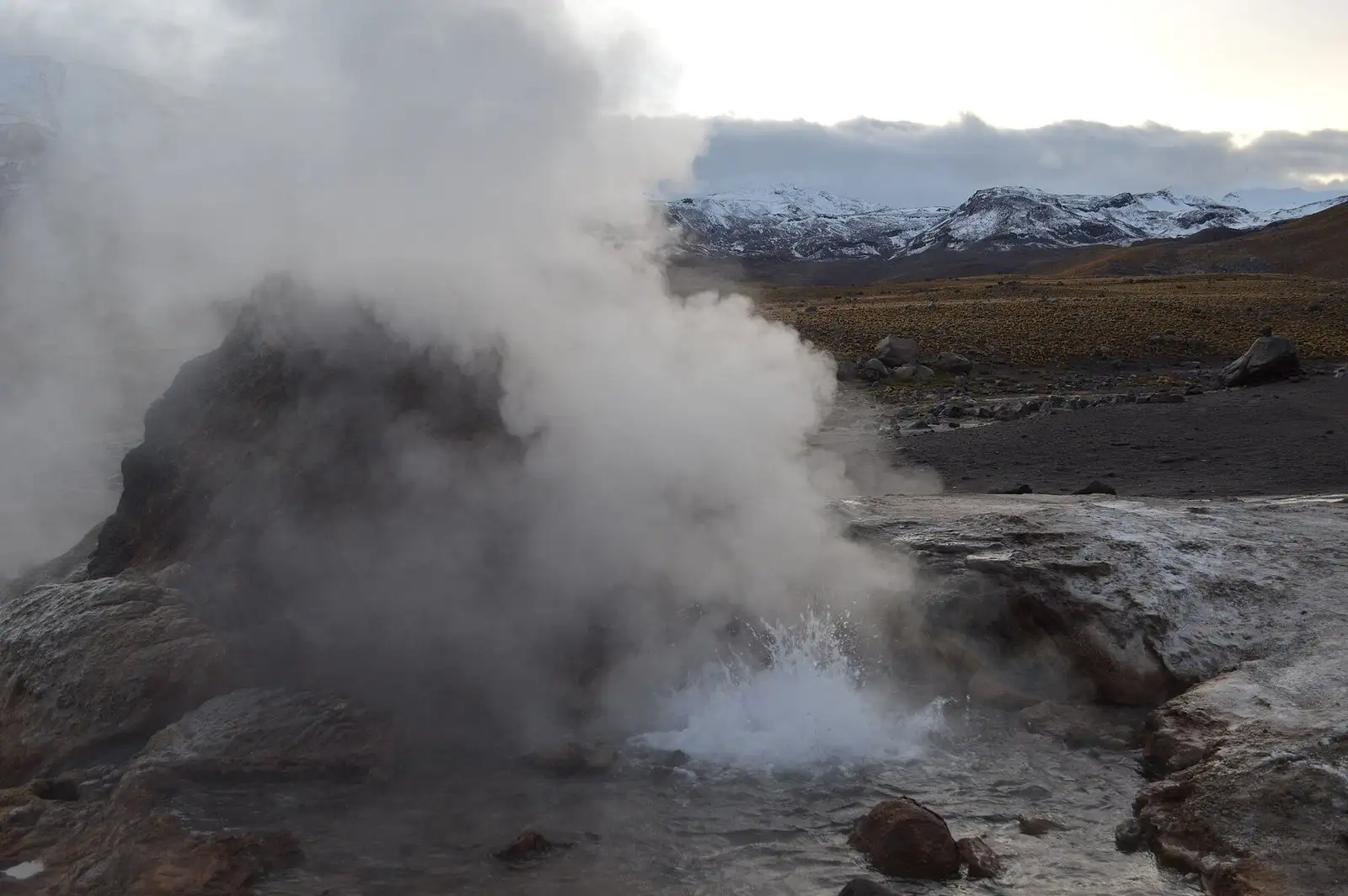
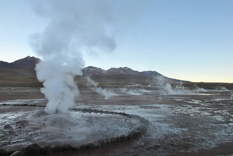
- Steam columns rising from the geysers at dawn, most visible on frosty mornings down to −20 °C
- The three areas of strongest geothermal activity, covering 10 square kilometres in total
- Geyser cones up to 3 metres high, built from a mineral called geyserite
- Some geysers lie in the bed of the Rio Salado river
- The Vega Rinconada wetland, with hydrothermal vents, west of the upper geyser basin
Pools and water temperature
- Hot spring pools
- 60–80 °C water temperature of the hot spring pools in the field
- Artificial pool, second geothermal area
- 15 × 30 m built for tourists
Good to know before you go
- Visitors are warned of scalding water and should not climb over the safety walls.
What you see
- The Tatio volcano crater, at about 4,280 m, with the geothermal area at its foot.
- The field lies at the foot of the Tatio and Linzor volcanoes.
- The tallest recorded eruptions, up to 5 m, came from geysers T25 and T72.
- Mud pools at the field's edges, which often produce highly acidic water.
- Rusted remains of an old experimental geothermal station on the southeast plateau.
- The name also refers to a nearby mountain shaped like a reclining man.
- The Laguna Colorada caldera lies to the east of the field.
- The field covers 30 square kilometres at 4,200–4,600 m of elevation.
With kids
- Nights can drop to −20 °C.
When it's busy
- Start of dawn
- especially impressive; low morning air and visibility, steam columns most visible from the FACTS, not from crowd data
- Cold weather
- geysers most noticeable in cold weather most geysers are found in one area
- Eruptions
- minor about every 12 minutes, major every few hours
- Whole trip
- several hours
Interesting facts11
-
The thin air at this altitude makes water boil at about 86 °C.
El Tatio - Wikipedia -

Temperatures can swing by as much as 40 °C between day and night, causing freeze-thaw cycles.
El Tatio - Wikipedia -

Scientists use the field as a stand-in for Mars, given its low air pressure and strong UV radiation.
El Tatio - Wikipedia -

A methanogen, Methanogenium tatii, was found in a warm pool and named after the field.
El Tatio - Wikipedia -

Cyanobacteria mats colour the channels and pools of the hot springs.
El Tatio - Wikipedia -
Microbes sort themselves by temperature: green bacteria in the hottest water, diatoms in cooler water.
El Tatio - Wikipedia -
Frog larvae live in water held at close to 25 °C and develop in an unusual way.
El Tatio - Wikipedia -
Mean winds of 3.7–7.5 m/s shape the finger-like sinter deposits.
El Tatio - Wikipedia -
Opal is the main mineral in the sinter deposits from the hot springs.
El Tatio - Wikipedia -
An estimated 8 % of the world's geysers are found here.
El Tatio - Wikipedia -
Geyser fountains here average about 75 cm high, lower than at the larger fields.
El Tatio - Wikipedia
History
The name comes from Kunza, a nearly extinct language, and means 'the weeping grandfather'. An old Inca trail from San Pedro de Atacama to Siloli crossed the field. The Inca also ran a mountain sanctuary on Volcan Tatio.
- 27,000–20,000 years agoGeothermal activity begins in the south and spreads north.
- late 19th centuryGeysers are first mentioned.
- 1920sGeothermal prospecting of the field begins.
- 1943The field first appears in academic literature.
- 1952Geysers are well known.
Show all
- 1974An experimental power station meant for electricity is abandoned because of technical problems.
- 2009A well blowout creates a steam column and stops geothermal power development.
- 2025Bathing in the old cement pool is no longer possible as of 2025.
Shorts



How to get there
- CarChile Route B-245 connects the field with San Pedro de Atacama, about 80 to 89 km north.
- CarRoute 21 reaches the field from Calama, about 125 km east, and passes the village of Chiu-Chiu.
- CarSeveral unpaved roads lead to the field.
- On footAll parts of the field are easy to reach on foot.
- On footA walkable ascent route to the volcano crater starts from San Pedro de Atacama.
Sources: El Tatio - Wikipedia · El Tatio - Wikipedia · El Tatio - Wikipedia · checked 18 Oct 2026
- Phone
- +56553280770
Questions and answers
How far is Geyser del Tatio from San Pedro de Atacama?
The field lies about 90 km north of San Pedro de Atacama. Chile Route B-245 connects the field to the town.
How do I get to Geyser del Tatio from Calama?
Route 21 reaches the field from Calama, about 125 km east, and passes the village of Chiu-Chiu.
Can you bathe at Geyser del Tatio?
The old cement pool, fed by cooled geyser water, has not been usable for bathing since 2025. A bathing pool exists where warm and cold water flow together.
Can you walk around Geyser del Tatio?
All parts of the field are easy to reach on foot. A walkable ascent route to the volcano crater starts from San Pedro de Atacama.
- See who's going — faces, not ticket counts.
- Write to someone who shares your interests — no swipes, no matches, no paywall.
- Pick the event or the place to meet at — and go together.