
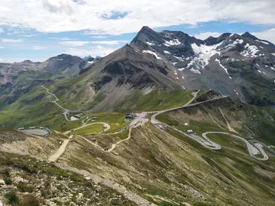

Großglockner High Alpine Road
Sign up free — See who's going and message them.
About
More photos 11
1 / 11


Why go
- Edelweißspitze at 2,571 metres, reached by a 1.6 km branch from Fuscher Törl.
- Views from Edelweißspitze across 37 peaks over 3,000 metres and 19 glaciers.
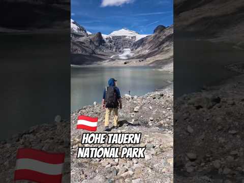
- Pasterze Glacier and the Großglockner massif from Kaiser-Franz-Josefs-Höhe.
Don't miss
- Pasterze GlacierSee the glacier from Kaiser-Franz-Josefs-Höhe, where it lies 280 metres below the road.Kaiser-Franz-Josefs-Höhe overlook.
- Hochtor tunnelThe tunnel crosses the Salzburg–Carinthia border and the Salzach–Drau watershed.At Hochtor.
History
The pass had been used since the Hallstatt period, and a railway route proposed around 1889 was never built. Construction began in 1930 to open Alpine valleys to motor tourism and provide jobs during the economic crisis. The road opened in 1935; an international car and motorcycle race followed the next day.
- 1924Engineer Franz Wallack was commissioned to plan the road.
- 1930Construction began at Ferleiten on 30 August with a blast.
- 1934Franz Rehrl and Franz Wallack made the first car crossing on the unfinished road.
- 1935The road opened on 3 August after five years of construction.
Tips for your visit
- At Fuscher Lacke, visit the exhibition about the road’s construction and the themed children’s play area beside the lake.
- At Kaiser-Franz-Josefs-Höhe, the Alpine Nature House presents mountain life and a film about marmots.
- Hochtor is a 25-minute walk away.
How to get there
- CarThe toll road runs from Bruck through Fusch, Fuscher Törl and Hochtor to Heiligenblut. From the north, it reaches the toll station at Ferleiten.
- CarThe 1.6 km branch from Fuscher Törl climbs to Edelweißspitze.
- CarA branch road leads to Kaiser-Franz-Josefs-Höhe above the Pasterze Glacier.
Shorts
-
 What You Discover Driving the Grossglockner High Alpine Road | AustriaThe Travel Creator
-
 Marmot! 😍 (Grossglockner High Alpine Road)knightontrip
-
 Grossglockner High Alpine Road: A Journey Through Alpine ParadisePositively Positive Mindset
-
 The Grossglockner High Alpine Road, Austrias most scenic road!Bella's Big Adventures
-
 Großglockner High Alpine RoadAbsentee
-
 Drive above the Clouds — Grossglockner Alpine RoadAmbient Walks & Drives
-
 📍GROSSGLOCKNER HIGH ALPINE ROADAdventure Express
-
 Scenic High Alpine RoadAmazingtouristspots
Interesting facts2
-

The road is Austria’s highest paved mountain pass road and reaches the 2,504-metre Hochtor pass.
Großglockner-Hochalpenstraße - Wikipedia -
 1953
Snow depth on the route has exceeded ten metres; the recorded maximum was 21 metres in 1953.
Haute route alpine du Großglockner - Wikipedia
Sources: Grossglockner High Alpine Road - Wikipedia · Heiligenblut - Wikivoyage (do) · Großglockner-Hochalpenstraße - Wikipedia · Haute route alpine du Großglockner - Wikipedia · checked 28 Oct 2026
Plan from here: Evening walk →
Questions and answers
How long does it take to drive the Grossglockner High Alpine Road?
No drive time is provided. The road runs 47.8 km from Bruck to Heiligenblut.
How do you get to the Grossglockner High Alpine Road?
The toll road runs from Bruck through Fusch, Fuscher Törl and Hochtor to Heiligenblut; the northern toll station is at Ferleiten.
What can children do at the Grossglockner High Alpine Road?
Children can use the themed play area beside Fuscher Lacke.
- See who's going — faces, not ticket counts.
- Write to someone who shares your interests — no swipes, no matches, no paywall.
- Pick the event or the place to meet at — and go together.