
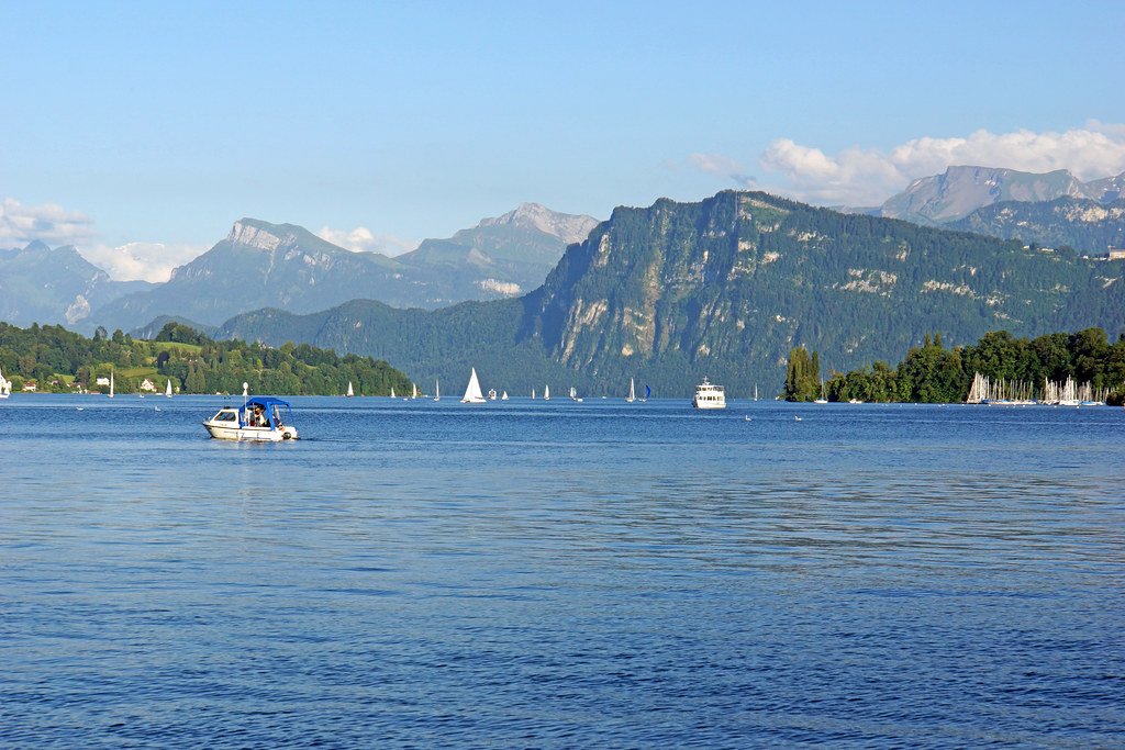
Lake Lucerne
Sign up free — See who's going and message them.
About
More photos 8
1 / 8


Why go
- Ride one of five historic paddle steamers.
- Walk the 35 km Swiss Path around Lake Uri.
- Take a boat trip and a cog railway to Rigi or Pilatus.
- Canoe between Brunnen and Gersau.
- Windsurf on southern Lake Uri, where winds blow through the Reuss Valley.
Don't miss
- Rütli meadowTraditionally regarded as the founding place of the Swiss Confederation.On the Urnersee shore.
- AlpnacherseeA lake basin at the foot of Pilatus, separated from the rest of Lake Lucerne by a 100-metre-wide channel.At the foot of Pilatus.
History
Before the Axenstrasse opened in 1865, the lake was the only northern route to Uri and the Gotthard.
- About 12,000 years agoThe Reuss glacier carved the basin; after it retreated, meltwater and rivers filled the lake.
- Around 1000 BCEA Bronze Age village stood beside the lake; its remains and artifacts were discovered on the lake bed during surveys in 2019–2021.
- 1230The lake was used for transport by at least 1230, when the Gotthard Pass opened.
- 1837The first steamer began carrying goods and passengers across the lake.
- 1865The Axenstrasse connected central Switzerland directly to the Gotthard Pass.
Show all
- 1871Europe’s first rack railway opened at Vitznau on the lake’s tourism route.
- 1889A cog railway from Alpnachstad to Mount Pilatus was built.
Tips for your visit
- Roads do not follow the entire shoreline, so a circuit involves inland stretches.
- For a Stanserhorn excursion, the funicular and cable car operate from April to November.
- Divers have about ten shore-accessible sites; the water stays chilly and is mostly very clear.
How to get there
- BoatPassenger boats connect 32 places along the shore and link with mainline and mountain railways.
- ParkingA car ferry crosses between Beckenried on the south bank and Gersau on the north.
- BoatRoute: Lucerne–Weggis–Vitznau–Beckenried–Brunnen–Flüelen.
- BoatRoute: Lucerne via Kehrsiten to Stansstad and Alpnachstad.
- BoatRoute: Lucerne to Küssnacht am Rigi.
- TrainTrain and road circuit: the rail route goes around the north side of the Rigi.
Shorts
-
 Scenic Journey on Lake Lucerne: Discover the Longest Cruise ExperienceSwitzerland for you
-
 POV: You spend the day hopping around Lake LucerneSwitzerland
-
 Peaceful Moments on Lake LucerneWander Lens 📸🏔️
-
 Adventures in Switzerland! Paragliding over Lake LucerneHJ Visuals
-
 Lake Lucerne , Switzerland |Desi Life in Europe
-
 Bürgenstock Resort Lake Lucerne SwitzerlandArbab Tv
-
 Lake LucerneLarissa DSa
-
 Enchanting Moments on Lake Lucerne: A Captivating Glimpse into Nature…The World in Realtime
Interesting facts5
-
The Reuss enters the lake at Flüelen and flows out at Lucerne.
Lake Lucerne - Wikipedia -
214 metres
The lake’s deepest point, 214 metres, lies in the Gersauer basin between Beckenried and Gersau.
Vierwaldstättersee - Wikipedia -
114 km²
Its branching shoreline is about 150 km long around a lake covering 114 km².
Lac des Quatre-Cantons - Wikipedia -
The lake’s water has drinking-water quality and remains in the basin for an average of three and a half years.
Vierwaldstättersee - Wikipedia -
In summer, the water can reach 22 °C.
Vierwaldstättersee - Wikipedia
Sources: Lake Lucerne - Wikipedia · Lake Lucerne - Wikipedia (part 2) · Vierwaldstättersee - Wikipedia · Lac des Quatre-Cantons - Wikipedia · Lago dei Quattro Cantoni - Wikipedia · checked 28 Sep 2026
Plan from here: Evening walk →
Questions and answers
What does Vierwaldstättersee mean?
The name refers to four historic Waldstätten: Uri, Schwyz, Unterwalden and Lucerne.
How deep is Lake Lucerne?
It reaches 214 metres deep in the Gersauer basin, between Beckenried and Gersau.
Why is the climate around Lake Lucerne mild?
Shelter from northern winds, warm foehn winds and the lake’s moderating effect contribute to the mild climate.
- See who's going — faces, not ticket counts.
- Write to someone who shares your interests — no swipes, no matches, no paywall.
- Pick the event or the place to meet at — and go together.