

Wells Gray Provincial Park
Sign up free — See who's going and message them.
Is this your place? Get the badge for your websiteAbout
More photos 11
1 / 11




Why go
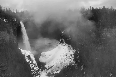
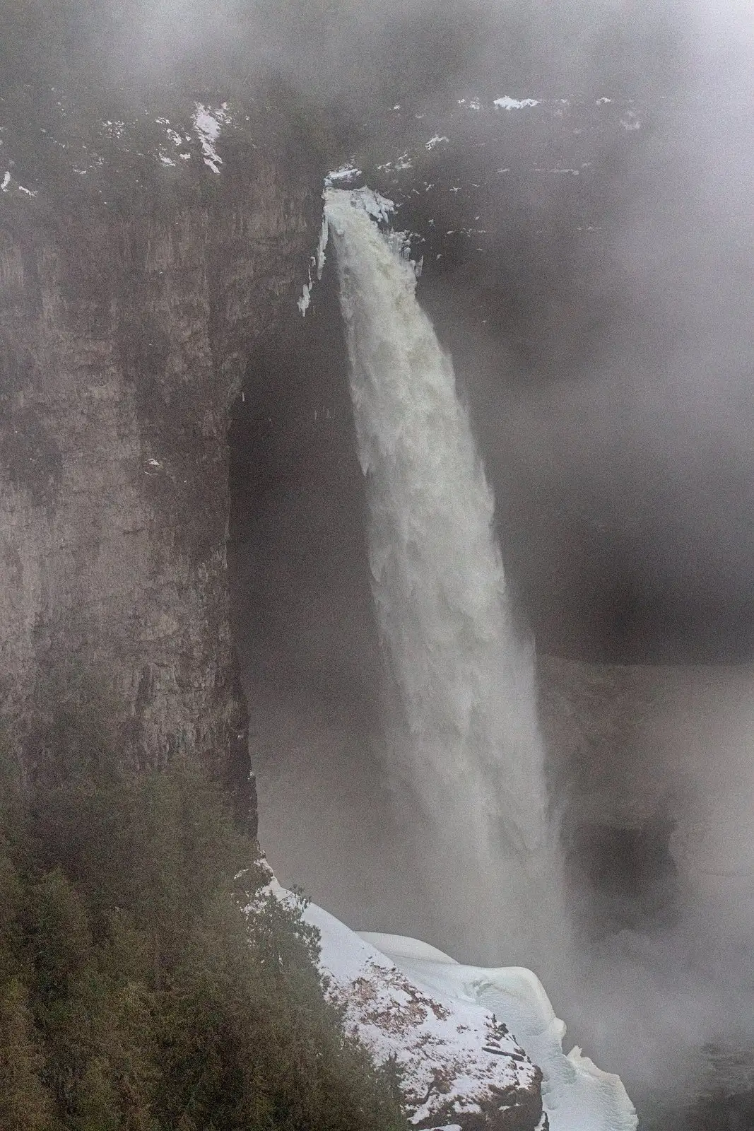
- Helmcken Falls plunges 141 metres over a volcanic plateau edge, making it Canada’s fourth-highest waterfall.
- Walk behind the 35-metre Moul Falls, the park’s only waterfall visitors can walk behind.
- Paddle Murtle Lake, North America’s largest paddle-only lake.
- See the Murtle River spread across Dawson Falls’ 90-metre-wide rock ledge.
- Look over the southern park and toward Mahood Lake from Green Mountain Viewing Tower.
What's in season
- JunTrophy Mountain meadows bloom in late June.
- Jul – AugTrophy Mountain meadows bloom again from late July to early August.
- Aug – SepSalmon can be seen trying to leap Bailey’s Chute during the run.
What you see
- The northern park has rugged mountains, glacial valleys and lakes including Clearwater, Azure and Hobson.
- The Braithwaite Icefield lies between Azure Lake and Hobson Lake.
- Garnet Peak, north of Azure Lake, is visible from many southern park viewpoints.
- Sidewalks on both sides of Third Canyon’s road bridge overlook two waterfalls and an 80-metre gorge.
- At the Mushbowl, Clearwater Valley Road bridges a narrow canyon exposing some of the park’s oldest rocks.
Best time to visit
- The park is open year-round, with hiking and paddling among its activities and skiing in winter.
- In very cold, snowy weather, an ice cone sometimes grows halfway up Helmcken Falls.
Shorts
-
 Walking Behind Moul Falls | Wells Gray Park, BCLifelong Trail
-
 Canada Waterfall Paradise At Wells Gray Provincial Park in BCWorldAdventurists
-
 Spahats Creek Falls | Wells Gray Provincial Park | Clearwater BCLifelong Trail
-
 Weekend at Wells grey provincial park Clearwater | Cinematic travel p…Unscripted Compass
-
 Helmecken Falls In Wells grey provincial parkUnscripted Compass
-
 Clearwater, Wells Gray park, Helmcken falls, Colombie Britannique, Ca…madophe
-
 Your sign to visit Wells Gray Provincial Park!Bella Bucchiotti
-
 Clearwater, Wells Gray park, Dawson falls, Colombie Britannique, Cana…madophe
History
Before European settlers arrived, the area was a hunting ground for Secwepemc, Tsilhqot'in and Canim Lake Indigenous People. Around 35 archaeological sites attest to Indigenous cultures here. Around 1875, conflict arose over access to caribou herds. The proposed dam plan was shelved within a year.
- 1862The Overlanders expedition rafted down the North Thompson River toward the Cariboo goldfields.
- 1863Lord Milton and Dr. Cheadle travelled through the North Thompson Valley and helped establish the Clearwater River name.
- 1913During a government survey, Robert Lee recorded Helmcken Falls.
- 1925The B.C. Auto Club began campaigning for a park around Helmcken Falls.
- 1939Wells Gray Provincial Park was established on 28 November and named for provincial minister Arthur Wellesley Gray.
Show all
- 1940Chess Lyons and Huntley Campbell surveyed the park and documented it with photographs.
- 1963A proposal called for seven Clearwater River dams and five reservoirs. The Sabre Tooth Rapids dam would have flooded much of Helmcken Canyon and submerged the bottom 10 metres of Helmcken Falls.
- 1972Volunteer guides led bus tours that asked visitors to imagine the valley flooded by the proposed dams.
- 1987The Clearwater River flooding reserve was cancelled.
- 1996Additions protected the Clearwater River Corridor and Trophy Mountain area.
How to get there
- CarIn Clearwater, turn off Highway 5 onto Clearwater Valley Road. It runs 68 km north to Clearwater Lake, with 42.2 km paved before the gravel section. Winter plowing ends at Helmcken Falls.
- On footClearwater Valley Road crosses the southern third of the park and serves its best-known attractions. Much of the north and east is nearly inaccessible; other areas require trail access.
- CarFrom Highway 24, Mahood Lake Road reaches Deception Point on Mahood Lake. A campground and beach are at the lake’s west end.
- CarFrom Blue River, follow the narrow gravel Murtle Lake Road for 27 km, then continue on foot to the lake’s boat launches.
- BoatBoat tours, rentals and a public launch at Clearwater Lake provide access to Clearwater Lake and Azure Lake.
Sources: Wells Gray Provincial Park - Wikipedia · Clearwater (British Columbia) - Wikivoyage (do) · Wells Gray Provincial Park - Wikipedia · Parc provincial Wells Gray - Wikipedia · checked 3 Oct 2026
- Website
- bcparks.ca/wells-gray-park/
- Phone
- +12503716200
Plan from here: Evening walk →
Questions and answers
Where can I camp in Wells Gray Provincial Park?
Two large campgrounds are at Clearwater Lake. Mahood Lake has a 37-site campground and a beach at its west end.
How can I explore Clearwater and Azure lakes in Wells Gray Provincial Park?
Boat tours, rentals and a public launch at Clearwater Lake provide access to both lakes.
Where can I view Helmcken Falls in Wells Gray Provincial Park?
A road reaches a viewing platform north of the canyon; a trail leads south and to the brink.
Where can I hike through mountain meadows in Wells Gray Provincial Park?
Trophy Mountain, at the park’s southern edge, has nine summits and hiking routes through its meadows and peaks.
What historic remains can I see in Wells Gray Provincial Park?
Ray Farm preserves the park’s oldest settlement remains and the graves of John and Alice Ray.
- See who's going — faces, not ticket counts.
- Write to someone who shares your interests — no swipes, no matches, no paywall.
- Pick the event or the place to meet at — and go together.